We continue to self-quarantine and social distance in an attempt to slow the spread of the coronavirus. Here is a visual representation and basic data on the spread of COVID-19 in Illinois in the past two weeks.
Two weeks ago (3/11) today (3/25) i made a map of the counties where confirmed cases of COVID-19 had been found in Illinois. Since then I have made a new one every few days or so. I decided to post these maps in chronological order below to show the spread of the coronavirus in the Land of Lincoln.
However, I do want to make a point. When the first map was made there had only been a fraction of the people tested for the virus. The visual you are about to see does not mean the efforts we are making are not working. With more people tested more positive tests will be found. I believe our efforts are making a difference when you compare Illinois to places like New York and Washington State.
I also only kept track of the number of people being tested starting with the 3/20 map. Prior to that there were not many actual tests available therefore a comparatively small number of people had been tested.
That being said below are the maps with the last map representing the information announced yesterday afternoon (3/24) by the Illinois Department of Public Health (IDPH).
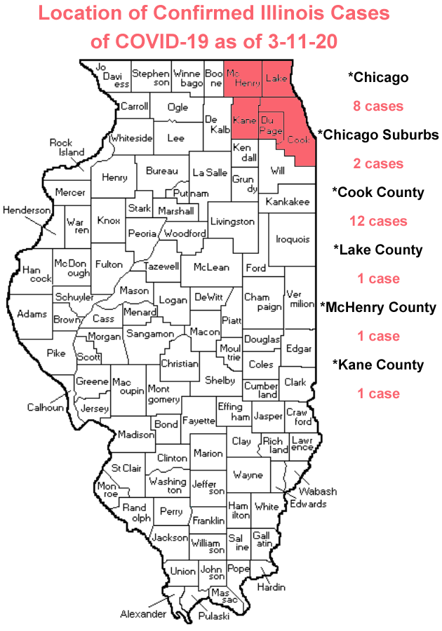
3-11-20:
25 confirmed cases
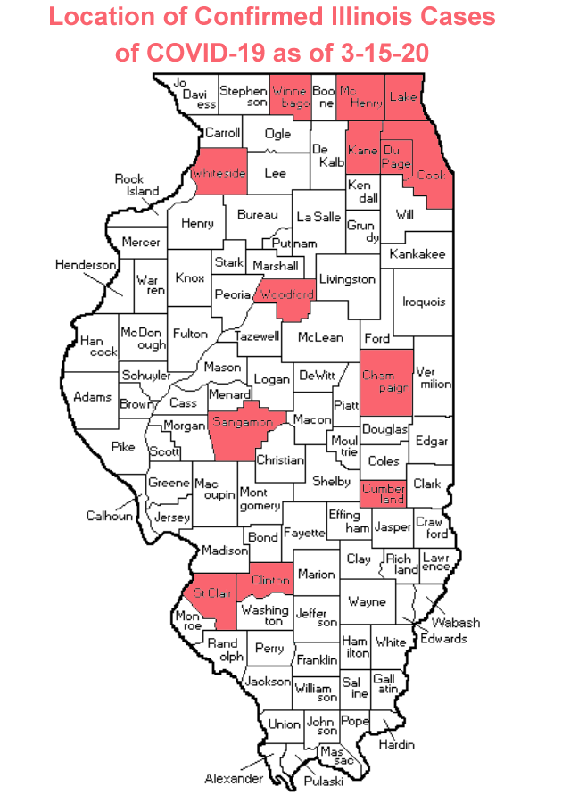
3-15-20:
93 confirmed cases
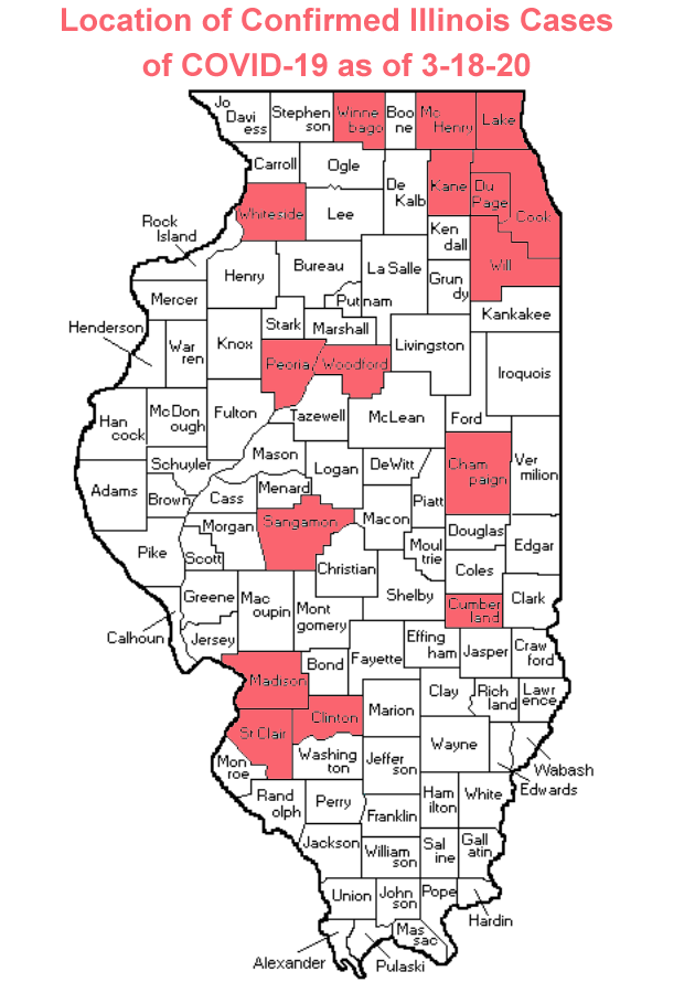
3-18-20:
288 confirmed cases
1 death
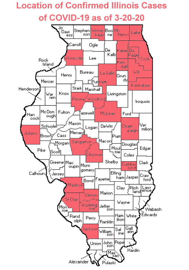
3-20-20:
585 confirmed cases
5 deaths
4,286 people tested
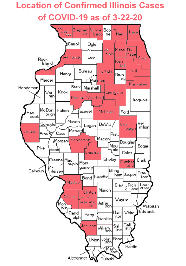
3-22-20:
1,049 confirmed cases
9 deaths
8,374 people tested
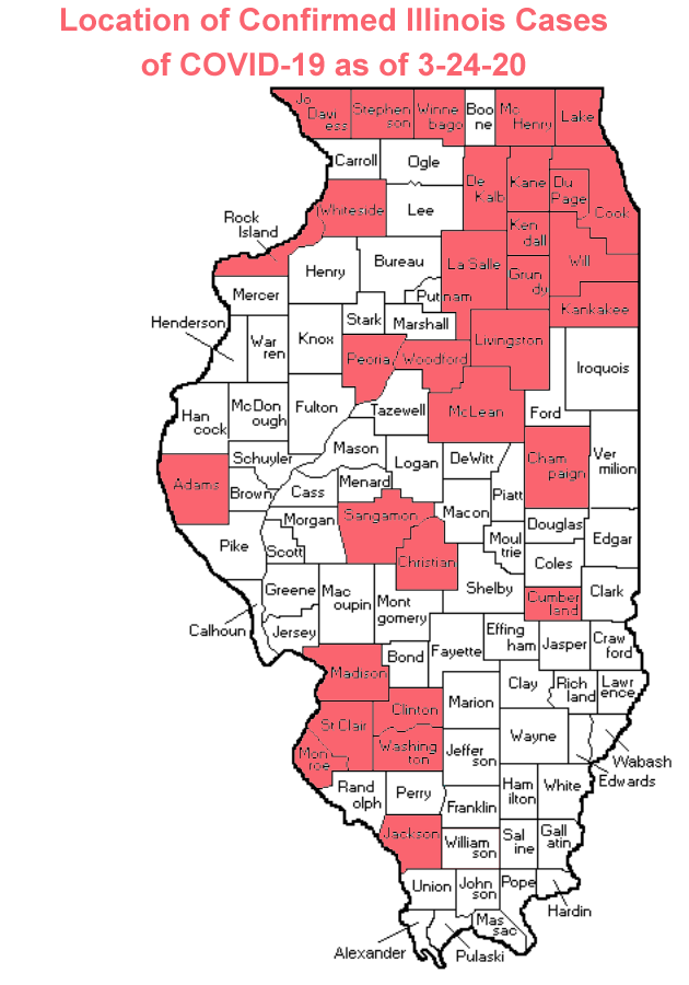
3-24-20:
1,535 confirmed cases
16 deaths
11,485 people tested
We still need to be diligent in doing our part to slow the spread of this virus and eventually stop it altogether. There are five simple rules to follow to help keep you and your family safe during this crisis.
- Wash your hands often with soap and warm water for at least 20 seconds.
- Avoid touching your eyes, nose, or mouth with unwashed hands.
- Cover your mouth when you sneeze or cough. If you do this into your hands, immediately wash them or use hand sanitizer on them.
- Social distance: stay at least three to six feet away from everybody else. Completely avoid close contact with people who are sick. Only go into public when you absolutely need or have to.
- If you feel sick, STAY HOME.
Remember, you can get reliable information at the McLean County Health Department website, the IDPH website and/or the Center for Disease Control (CDC) website.
By: Buck Stevens